Subdivisions
Whether you are a residential landowner wanting to maximise the potential of your property, or a rural landowner looking to subdivide your farm or lifestyle block, there is a lot to consider. The subdivision process can be complicated and lengthy, and every subdivision has its own challenges.
At Robertson Land Surveys we make the subdivision process simple. We can evaluate your property to assess subdivision potential, carry out a topographical survey to design the optimal subdivision layout, and deal with all council consenting matters. We manage the entire process for you.
From Tauranga to the Western Bay of Plenty and South Waikato, we are your local subdivision and land surveying experts.
What Is the Process for Subdividing Land?
1. The Assessment
Subdividing your land may seem like a good idea to unlock profit from your property, but is your land actually suitable for subdivision? District Plan rules, zoning, section size, access and servicing are some of the factors that need to be considered. We can assess your property, review legal documentation and put together a subdivision feasibility report, which includes time and cost estimates, so you can then make an informed decision to subdivide.
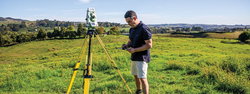
2. The Plan
Once you have decided to go ahead with your subdivision you will need a topographical survey of your property. This survey will include buildings, features and services. Ground levels will also be surveyed to calculate contours. With your input we can then create a scheme plan showing the proposed layout, including provision for access and servicing.
3. The Consent
Resource consent is required from your local council. This step can be daunting, however Robertson Land Surveys can manage the entire application process for you. We have good relationships with all of our local councils and we work hard to get the results.
4. Design & Construction
Once Resource Consent is issued, design and construction can get underway. We oversee design and construction work, to ensure resource consent conditions are met. Our team will manage the entire project including engineering design approval, arranging the contractors and final certification. Having your subdivision project managed by a qualified land surveyor, is a great way to ensure everything runs smoothly.
5. Land Transfer Survey
Our licensed surveyors undertake calculations to define your property boundaries. We do fieldwork to place new boundary marks. An electronic dataset is prepared comprising survey and title plans, easement schedules, calculations and reports. We will liaise with your solicitor throughout the process.
6. Final Certification
We will look after the final documentation process. This will include sign-off from council that all conditions in the Resource Consent have been met. Again we liaise with your solicitor, assisting with the preparation of legal documents to submit to Land Information New Zealand (LINZ). New titles will then be issued by LINZ.
Have an upcoming project?
Work with us!